|
Indonesia
Indonesia is a modern country made up of over 17,000 islands (6000 inhabited), many of which have been known to western mapmakers for hundreds of years. The "spice islands" and "East Indies" or "Dutch East Indies" that drove much of 16th and 17th century European trade and exploration were generic names for islands located in modern-day Indonesia.
This page contains maps of the East Indies as a whole, or with several islands. Additional pages include maps of specific islands in the archipelago:
 |
Fries, 1522
Earliest map of southeast Asia. India and Ceylon are on the left, with the major islands of Indonesa in the lower right. |
 |
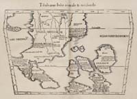
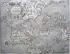
Ruscelli, 1561
A very early (and grossly inaccurate) map of the East Indies. Sumatra is the large island to the left of the crease. See the Porcacchi map below for a better image of a very similar map. |
 |
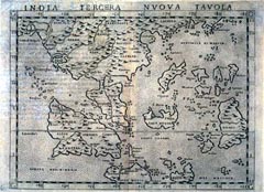
Gastaldi, 1563
Similar to the Ruscelli map above, note that this map has south at the top of the map, showing the East Indies from the perspective of mainland Asia.
|
 |
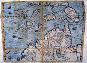
Porcacchi, 1572
This map is virtually identical to the Ruscelli map above. |
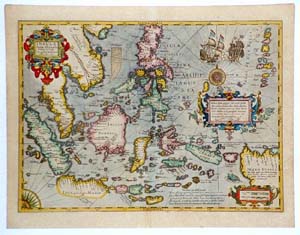 |
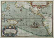
Mercator/Hondius, 1606
A very colorful and reasonably accurate map of the East Indies, Philippines (upper center) and Marianas Islands (upper right). Sumatra is the island on the left in blue, Java in yellow in the south, and Borneo in pink above Java. |
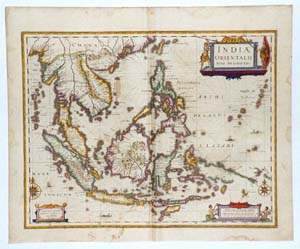 |
Jansson, 1636
An interesting contrast to the Mercator map created only thirty years earlier, this map shows very accurate representations of the same area. This reflects the significant amount of exploration in the area by the Dutch. |
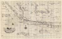 |
Dudley, 1646
Sea chart of Indonesia. |
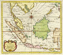 |
Bellin, 1755
A map focusing on the western part of Indonesia. Sumatra is the orange island north of the cartouche (compare the shape to the Ptolemy map), Java the pink island on the bottom, Sulawesi the orange island partly shown on the right, and Kalimantan (then called Borneo) the green island in the center. |
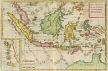 |
Bonne, 1780
A map covering most of what is Indonesia today, extending east to Irian Jaya (eastern part of the island of New Guinea). The inset in the left hand corner includes a detail of the Moluccas. |
|