|
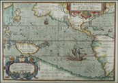
Solomon Islands
Located east of Papua New Guinea, the Solomon Islands were the location of many major battles in World War II.
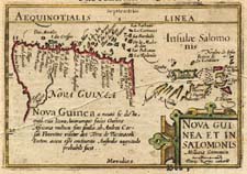 |
Langenes, 1598
This early map of New Guinea includes the Solomon Islands (spelled "Salomon") as well. |
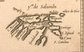 |
Herrera, 1601
Detail from a map of the East Indies, showing and naming the various Solomon Islands. Note the odd shape of some of the islands, that appear as if they are peninsulas. |
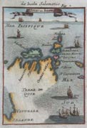 |
Mallett, 1683
A small map showing the Solomon Islands and the northern coast of New Guinea. Note how the Solomon Islands have been attached to northern New Zealand at the bottom.
|
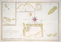 |
Bonne, 1770
Map showing two small groups of islands within the Solomon Islands. Then known as Queen Charlotte's Islands, these consisted of a variety of smaller islands, with Lord Egmont's Island being the large one in the center of the map. Currently called the Santa Cruz Islands. |
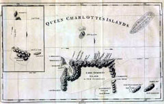 |
Hawkesworth, 1773
Similar map to the Bonne map above. |
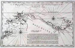 |
Bowen, 1744
A detailed sea chart of northern New Guinea, still all that is known at this time.
|
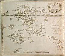 |
Tirion, 1753
A detailed chart of the northwest coast of the island of New Guinea (Irian Jaya today), including the islands of Salawati and Misool. |
 |
Vaugondy, 1774
Very detailed map of the explored portions of New Guinea (north and west coasts), while the southern portion remains unmapped. |
|